
The Great State of Arizona
Arizona is a state in the southwestern region of the United States. It is also part of the Western and the Mountain states. It is the sixth largest and the 14th most populous of the 50 states. Its capital and largest city is Phoenix. Arizona is one of the Four Corners states. It has borders with New Mexico, Utah, Nevada, California, and Mexico, and one point in common with the southwestern corner of Colorado. Arizona’s border with Mexico is 389 miles (626 km) long, on the northern border of the Mexican states of Sonora and Baja California.
Arizona is the 48th state and last of the contiguous states to be admitted to the Union, achieving statehood on February 14, 1912. Historically part of the territory of Alta California in New Spain, it became part of independent Mexico in 1821. After being defeated in the Mexican–American War, Mexico ceded much of this territory to the United States in 1848. The southernmost portion of the state was acquired in 1853 through the Gadsden Purchase.
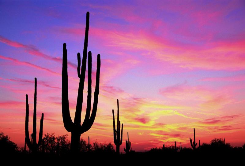
Southern Arizona is known for its desert climate, with very hot summers and mild winters. Northern Arizona features forests of pine, Douglas fir, and spruce trees; the Colorado Plateau; some mountain ranges (such as the San Francisco Mountains); as well as large, deep canyons, with much more moderate summer temperatures and significant winter snowfalls. There are ski resorts in the areas of Flagstaff, Alpine, and Tucson. In addition to the Grand Canyon National Park, there are several national forests, national parks, and national monuments.
About one-quarter of the state is made up of Indian reservations that serve as the home of 27 federally recognized Native American tribes, including the Navajo Nation, the largest in the state and the United States, with more than 300,000 citizens. Although federal law gave all Native Americans the right to vote in 1924, Arizona excluded those living on reservations from voting until its state Supreme Court ruled in 1948 in favor of Native American plaintiffs.
Arizona Climate:
Due to its large area and variations in elevation, the state has a wide variety of localized climate conditions. In the lower elevations, the climate is primarily desert, with mild winters and extremely hot summers. Typically, from late fall to early spring, the weather is mild, averaging a minimum of 60 °F (16 °C). November through February are the coldest months, with temperatures typically ranging from 40 to 75 °F (4 to 24 °C), with occasional frosts.
About midway through February, the temperatures start to rise, with warm days, and cool, breezy nights. The summer months of June through September bring a dry heat from 90–120 °F (32–49 °C), with occasional high temperatures exceeding 125 °F (52 °C) having been observed in the desert area. Arizona’s all-time record high is 128 °F (53 °C) recorded at Lake Havasu City on June 29, 1994, and July 5, 2007; the all-time record low of −40 °F (−40 °C) was recorded at Hawley Lake on January 7, 1971.
Due to the primarily dry climate, large diurnal temperature variations occur in less-developed areas of the desert above 2,500 feet. The swings can be as large as 83 °F (28 °C) in the summer months. In the state’s urban centers, the effects of local warming result in much higher measured night-time lows than in the recent past.
Arizona has an average annual rainfall of 12.7 in (323 mm), which comes during two rainy seasons, with cold fronts coming from the Pacific Ocean during the winter and a monsoon in the summer.[26] The monsoon season occurs toward the end of summer. In July or August, the dewpoint rises dramatically for a brief period. During this time, the air contains large amounts of water vapor. Dewpoints as high as 81 °F (27 °C) have been recorded during the Phoenix monsoon season. This hot moisture brings lightning, thunderstorms, wind, and torrential, if usually brief, downpours. These downpours often cause flash floods, which can turn deadly. In an attempt to deter drivers from crossing flooding streams, the Arizona Legislature enacted the Stupid Motorist Law. It is rare for tornadoes or hurricanes to occur in Arizona.
Arizona’s northern third is a plateau at significantly higher altitudes than the lower desert, and has an appreciably cooler climate, with cold winters and mild summers, though the climate remains semiarid to arid. Extremely cold temperatures are not unknown; cold air systems from the northern states and Canada occasionally push into the state, bringing temperatures below 0 °F (−18 °C) to the state’s northern parts.
Indicative of the variation in climate, Arizona is the state which has both the metropolitan area with the most days over 100 °F (38 °C) (Phoenix), and the metropolitan area in the lower 48 states with the most days with a low temperature below freezing (Flagstaff).
| Location | July (°F) | July (°C) | December (°F) | December (°C) |
|---|---|---|---|---|
| Phoenix | 106/83 | 41/28 | 66/45 | 19/7 |
| Tucson | 100/74 | 38/23 | 65/39 | 18/4 |
| Yuma | 107/82 | 42/28 | 68/46 | 20/8 |
| Flagstaff | 81/51 | 27/11 | 42/17 | 6/–8 |
| Prescott | 89/60 | 32/16 | 51/23 | 11/–5 |
| Kingman | 98/66 | 37/19 | 56/32 | 13/0 |
Arizona History:
For thousands of years before the modern era, Arizona was home to numerous Native American tribes. Hohokam, Mogollon and Ancestral Puebloan cultures were among the many that flourished throughout the state. Many of their pueblos, cliffside dwellings, rock paintings and other prehistoric treasures have survived, attracting thousands of tourists each year.
The first European contact by native peoples was with Marcos de Niza, a Spanish Franciscan, in 1539. He explored parts of the present state and made contact with nativeinhabitants, probably the Sobaipuri. The expedition of Spanish explorer Coronado entered the area in 1540–1542 during its search for Cíbola.
Father Kino was the next European in the region. A member of the Society of Jesus (“Jesuits“), he led the development of a chain of missions in the region. He converted many of the Indians to Christianity in the Pimería Alta (now southern Arizona and northern Sonora) in the 1690s and early 18th century. Spain founded presidios (“fortified towns”) at Tubac in 1752 and Tucson in 1775.
When Mexico achieved its independence from the Kingdom of Spain and its Spanish Empire in 1821, what is now Arizona became part of its Territory of Nueva California, (“New California”), also known as Alta California (“Upper California”). Descendants of ethnic Spanish and mestizo settlers from the colonial years still lived in the area, with much deeper roots than later European-American migrants from the United States.
.png)
During the Mexican–American War (1847-1848), the U.S. Army occupied the national capital of Mexico City and pursued its claim to much of northern Mexico, including what later became Arizona Territory in 1863 and later the State of Arizona in 1912. The Treaty of Guadalupe Hidalgo (1848) specified that, in addition to language and cultural rights of the existing inhabitants of former Mexican citizens being considered as inviolable, the sum of US$15 million dollars in compensation (equivalent to $415,211,538.46 in 2016.) be paid to the Republic of Mexico. In 1853 the U.S. acquired the land south below the Gila River from Mexico in the Gadsden Purchase along the southern border area as encompassing the best future southern route for a transcontinental railway.
What is now known as the state of Arizona was initially administered by the United States government as part of the Territory of New Mexico until the southern part of that region seceded from the Union to form the Territory of Arizona. This newly established territory was formally organized by the Confederate States government on Saturday, January 18, 1862, when President Jefferson Davis approved and signed An Act to Organize the Territory of Arizona, marking the first official use of the name “Territory of Arizona”. The Southern territory supplied the Confederate government with men, horses, and equipment. Formed in 1862, Arizona scout companies served with the Confederate States Army during the Civil War. Arizona has the westernmost military engagement on record during the Civil War with the Battle of Picacho Pass.
_and_his_warriors_in_1886.jpg)
The Federal government declared a new U.S. Arizona Territory, consisting of the western half of earlier New Mexico Territory, in Washington, D.C., on February 24, 1863. These new boundaries would later form the basis of the state. The first territorial capital, Prescott, was founded in 1864 following a gold rush to central Arizona.
Although names including “Gadsonia”, “Pimeria”, “Montezuma”, and “Arizuma” had been considered for the territory,[35] when 16th President Abraham Lincoln signed the final bill, it read “Arizona,” and that name was adopted. (Montezuma was not derived from the Aztec emperor, but was the sacred name of a divine hero to the Pima people of the Gila River Valley. It was probably considered—and rejected—for its sentimental value before Congress settled on the name “Arizona.”)
Brigham Young, pa triarchal leader of The Church of Jesus Christ of Latter-day Saints in Salt Lake City in Utah, sent Mormons to Arizona in the mid- to late 19th century. They founded Mesa, Snowflake, Heber, Safford, and other towns. They also settled in the Phoenix Valley (or “Valley of the Sun”), Tempe, Prescott, and other areas. The Mormons settled what became northern Arizona and northern New Mexico. At the time these areas were located in a part of the former New Mexico Territory.
20th century to present
During the Mexican Revolution from 1910 to 1920, several battles were fought in the Mexican towns just across the border from Arizona settlements. Throughout the revolution, numerous Arizonans enlisted in one of the several armies fighting in Mexico. Only two significant engagements took place on U.S. soil between U.S. and Mexican forces: Pancho Villa‘s 1916 Columbus Raid in New Mexico, and the Battle of Ambos Nogales in 1918 in Arizona. The Americans won the latter.
After U.S. soldiers were fired on by Mexican federal troops, the American garrison launched an assault into Nogales, Mexico. The Mexicans eventually surrendered after both sides sustained heavy casualties. A few months earlier, just west of Nogales, an Indian War battle had occurred, considered the last engagement in the American Indian Wars, which lasted from 1775 to 1918. U.S. soldiers stationed on the border confronted Yaqui Indians who were using Arizona as a base to raid the nearby Mexican settlements, as part of their wars against Mexico.
Arizona became a U.S. state on February 14, 1912. Arizona was the 48th state admitted to the U.S. and the last of the contiguous states to be admitted.
 Cotton farming and copper mining, two of Arizona’s most important statewide industries, suffered heavily during the Great Depression. But during the 1920s and even the 1930s, tourism began to develop as the important Arizonan industry it is today. Dude ranches, such as the K L Bar and Remuda in Wickenburg, along with the Flying V and Tanque Verde in Tucson, gave tourists the chance to take part in the flavor and activities of the “Old West”. Several upscale hotels and resorts opened during this period, some of which are still top tourist draws. They include the Arizona Biltmore Hotel in central Phoenix (opened 1929) and the Wigwam Resort on the west side of the Phoenix area (opened 1936).
Arizona was the site of German POW camps during World War II and Japanese-American internment camps. Because of wartime fears of Japanese invasion of the West Coast, the government authorized the removal of all Japanese-American residents from western Washington, western Oregon, all of California, and western Arizona. From 1942 to 1945, they were forced to reside in internment camps built in the interior of the country. Many lost their homes and businesses in the process. The camps were abolished after World War II.
The Phoenix-area German POW site was purchased after the war by the Maytag family (of major home appliance fame). It was developed as the site of the Phoenix Zoo. A Japanese-American internment camp was located on Mount Lemmon, just outside the state’s southeastern city of Tucson. Another POW camp was located near the Gila River in eastern Yuma County.
Arizona was also home to the Phoenix Indian School, one of several federal Indian boarding schools designed to assimilate Native American children into mainstream European-American culture. Children were often enrolled into these schools against the wishes of their parents and families. Attempts to suppress native identities included forcing the children to cut their hair, to take and use English names, to speak only English, and to practice Christianity rather than their native religions.
Numerous Native Americans from Arizona fought for the United States during World War II. Their experiences resulted in a rising activism in the postwar years to achieve better treatment and civil rights after their return to the state. After Maricopa County did not allow them to register to vote, in 1948 veteran Frank Harrison and Harry Austin, of the Mojave-Apache Tribe at Fort McDowell Indian Reservation, brought a legal suit, Harrison and Austin v. Laveen, to challenge this exclusion. The Arizona Supreme Court ruled in their favor.
Arizona’s population grew tremendously with residential and business development after World War II, aided by the widespread use of air conditioning, which made the intensely hot summers more comfortable. According to the Arizona Blue Book (published by the Arizona Secretary of State‘s office each year), the state population in 1910 was 294,353. By 1970, it was 1,752,122. The percentage growth each decade averaged about 20% in the earlier decades, and about 60% each decade thereafter.
In the 1960s, retirement communities were developed. These were special age-restricted subdivisions catering exclusively to the needs of senior citizens; they attracted many retirees who wanted to escape the harsh winters of the Midwest and the Northeast. Sun City, established by developer Del Webb and opened in 1960, was one of the first such communities. Green Valley, south of Tucson, was another such community, designed as a retirement subdivision for Arizona’s teachers. Many senior citizens from across the U.S. and Canada come to Arizona each winter and stay only during the winter months; they are referred to as snowbirds.
In March 2000, Arizona was the site of the first legally binding election ever held over the internet to nominate a candidate for public office. In the 2000 Arizona Democratic Primary, under worldwide attention, Al Goredefeated Bill Bradley. Voter turnout in this state primary increased more than 500% over the 1996 primary.
Three ships named USS Arizona have been christened in honor of the state, although only USS Arizona (BB-39) was so named after statehood was achieved.
We buy vacant land in Arizona and all surrounding areas in the Southwest. If you need to sell your land fast in Arizona, connect with us… we’d love to make you a fair no-obligation no-hassle offer. Take it or leave it. You’ve got nothing to lose 🙂